EagleHawk delivers large-scale, high-resolution aerial imaging and detailed condition data to streamline claims, validate repairs, and reduce the risk of major losses. From routine inspections to storm response, insurance carriers and public adjusters need fast, accurate visibility into property conditions across broad geographic areas.
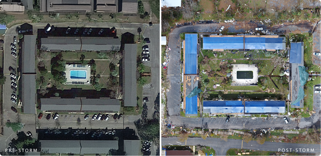
Assess properties quickly before and after weather events. High-resolution aerial and thermal imagery helps identify and verify damage.
Detect early signs of damage, deterioration, or risk, reducing the chances of failures and large claims with routine inspections.
Capture imagery across large geographic areas in a single flight to more efficiently assess multiple policyholders, neighborhoods, or commercial zones.
Provide independent, third-party damage assessments to strengthen client claims and clarify the scope of repairs needed.
Ensure insurance funds are used appropriately by verifying that repairs and replacements are completed as intended, with before-and-after documentation.
Streamline risk management, claims validation, and storm damage assessments with EagleHawk’s aerial imaging and visual documentation tools.
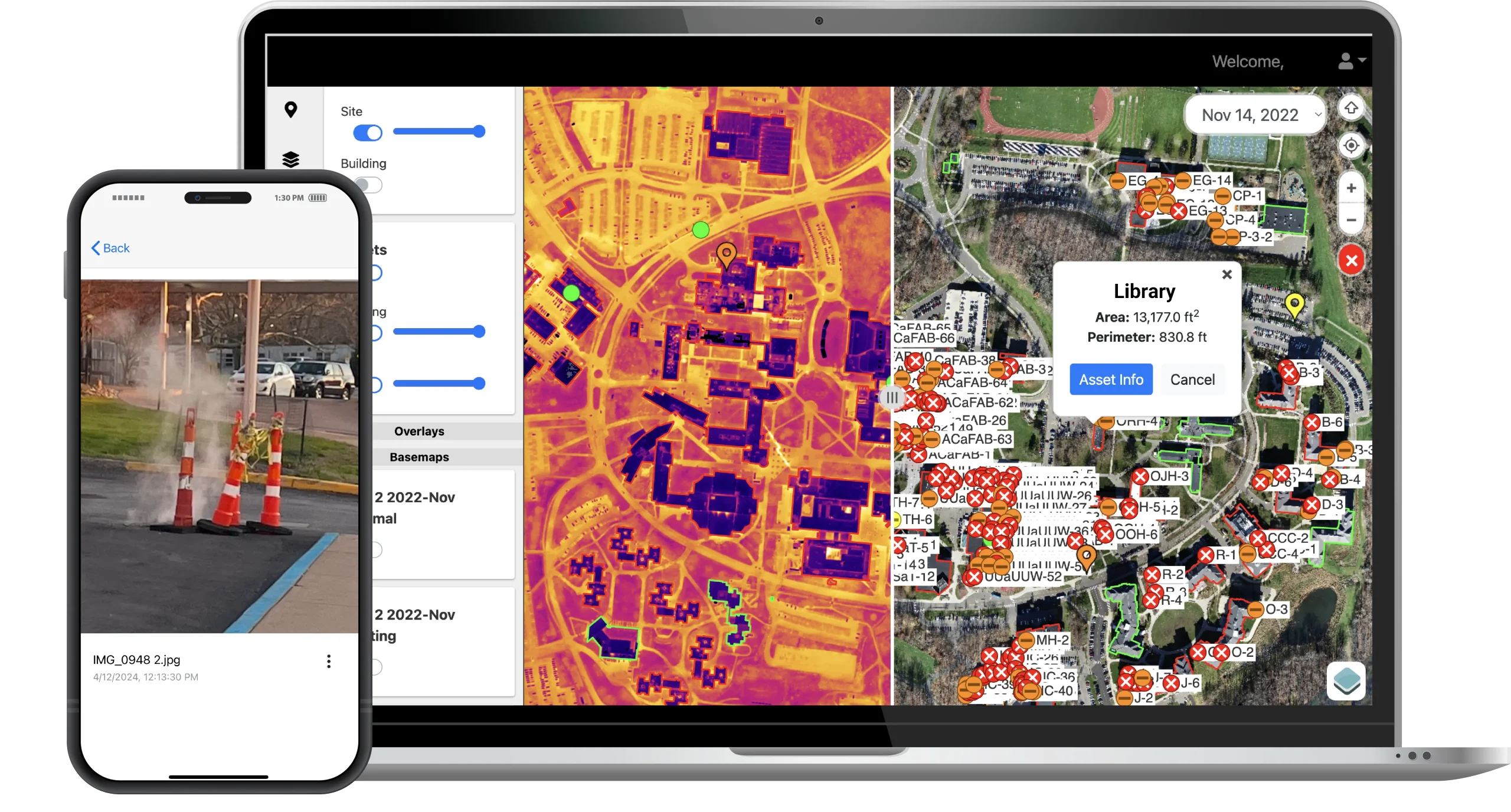
All of your inspection data in one platform:
Whether insuring commercial real estate, municipal property, or supporting individual policyholders, EagleHawk helps you validate claims, reduce risk, and make better-informed decisions with confidence.