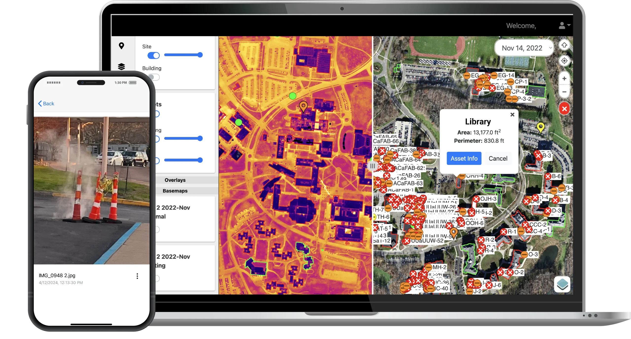
High-resolution aerial imagery, integrated utility data, & dynamic mapping tools solve issues for large facility management & underground utilities. Outdated satellite imagery, scattered records, and static maps make effectively managing such locations difficult. EagleHawk solves this challenge all within the EagleHawk Facilities Intelligence Platform.
There’s no need for a separate GIS solution to take advantage of these features; however, if there is an existing GIS system in place, EagleHawk’s data can be easily exported and integrated into leading platforms like ArcGIS, QGIS, or AutoCAD to enhance and augment current datasets.
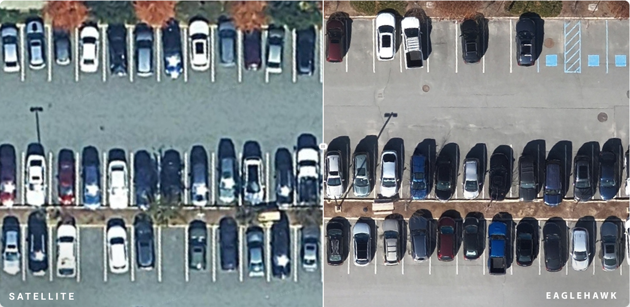
Get current, accurate visuals of large areas with high-resolution maps instead of relying on outdated satellite images.
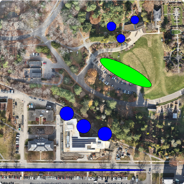
Overlay utility diagrams and construction drawings onto real-world imagery to align design plans with actual conditions.
Monitor site changes and verify project milestones by comparing imagery, elevation profiles, and project plans to monitor changes and verify progress.
View side-by-side imagery from any two points in time to evaluate condition changes or project development. Plus, store and manage documents and records in one digital location.
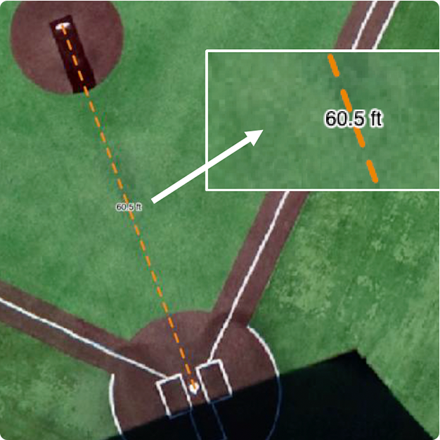
Calculate distances, areas, and perimeters from aerial maps instantly for better planning and resource allocation.
Access turn-by-turn directions to specific buildings, issues, or infrastructure components with built-in GPS tools.
Our team is here to answer your questions and demonstrate how the EagleHawk Facilities Intelligence Platform can work for your industry. Submit the form below, and a team member will contact you to schedule a private demo.
EagleHawk transforms how facilities visualize, manage, and plan with spatial data—bringing clarity, accuracy, and efficiency to utility mapping and infrastructure management.
See how EagleHawk can improve visibility, streamline planning, and turn complex data into actionable insights.