
Services
WHY WE’RE DIFFERENT
Our drone-enabled inspections are easier, faster, safer, and more affordable than traditional inspection methods. However, EagleHawk’s value goes beyond just drone flying. Although we’re excellent pilots, we recognize that our customers care most about the data and the insights generated from our inspection services. That’s why our team consists of engineers, thermographers, GIS experts, and innovators. Our experience and expertise allow us to deliver unmatched reports and informative insights.
Commercial Roof Inspections
EagleHawk provides fast service, reliable data, and state-of-the art reporting on the condition of your commercial roof. EagleHawk is an industry leader when it comes to offering an accurate, safe, and innovative inspection process of your roof using drones and thermal imaging technology and analysis.

District Heating System Inspections
EagleHawk collects and analyzes both visual and thermal data of heated piping networks to assess the overall performance and identify leaks within a system. EagleHawk’s method is safer and has proven that routine assessments can save a great deal of physical and financial resources, as well as improve the energy efficiency of a system.

Envelope and Facade Inspections
EagleHawk completes multi-building and multi-level (high-rise) exterior building envelope and detailed facade inspections using drones and high-definition cameras. EagleHawk inspections are safer and more efficient than traditional inspection methods.

Maps & GIS
EagleHawk has collected high resolution imagery and mapped tens of thousands of acres of the earth using drones for numerous mapping purposes and projects.
Change Detection
Damage Assessments and Inspections
Elevation Data / topography
Updated high resolution ortho-imagery

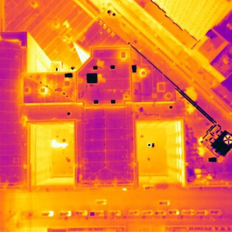
Solar Panel Inspections
EagleHawk's solar panel inspections includes both standard and thermal imaging of the solar panels using two remotely piloted aircraft and specialized cameras. The images are then analyzed for anomalies to detect possible energy output issues within the panel system.

Utilities Infrastructure
EagleHawk pushes the limits of technology and integration by finding new ways to utilize drones through specialized sensor integration on UAV’s.
EagleHawk conducts drone-enabled mapping and inspection operations for utility companies including:
Right of ways (ROW) mapping
Aerial methane leak detection
Pipeline integrity inspection